
2014 sees the 50th anniversary of the holding of the ISDT 1964 in Erfurt, East Germany. The event is one which gets a lot of attention and is number one International when it comes to enquiries and hits on our web search.
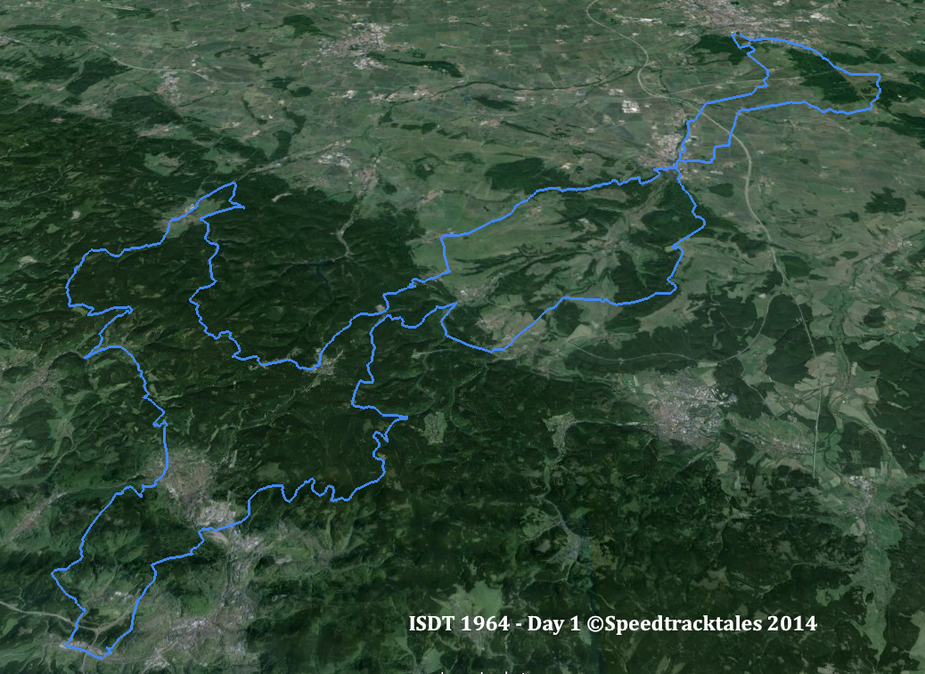
image – route of day 1 ISDT 1964 (Google Earth)
Thanks to the help of our contributor STB who has sent the route maps for the event which we will add to the ‘mapping the ISDT project’ this winter. Keep watching this page to see how it progresses.

image – Course map Day 1 & 3 ISDT 1964 (Courtesy Harro Esmarch Collection)
image – profile of day 1 ISDT 1964 (Google Earth)

image – Course map Day 2 & 5 ISDT 1964 (Courtesy Harro Esmarch Collection)

image – route of day 2 ISDT 1964 (Google Earth)
image – profile of day 2 ISDT 1964 (Google Earth)
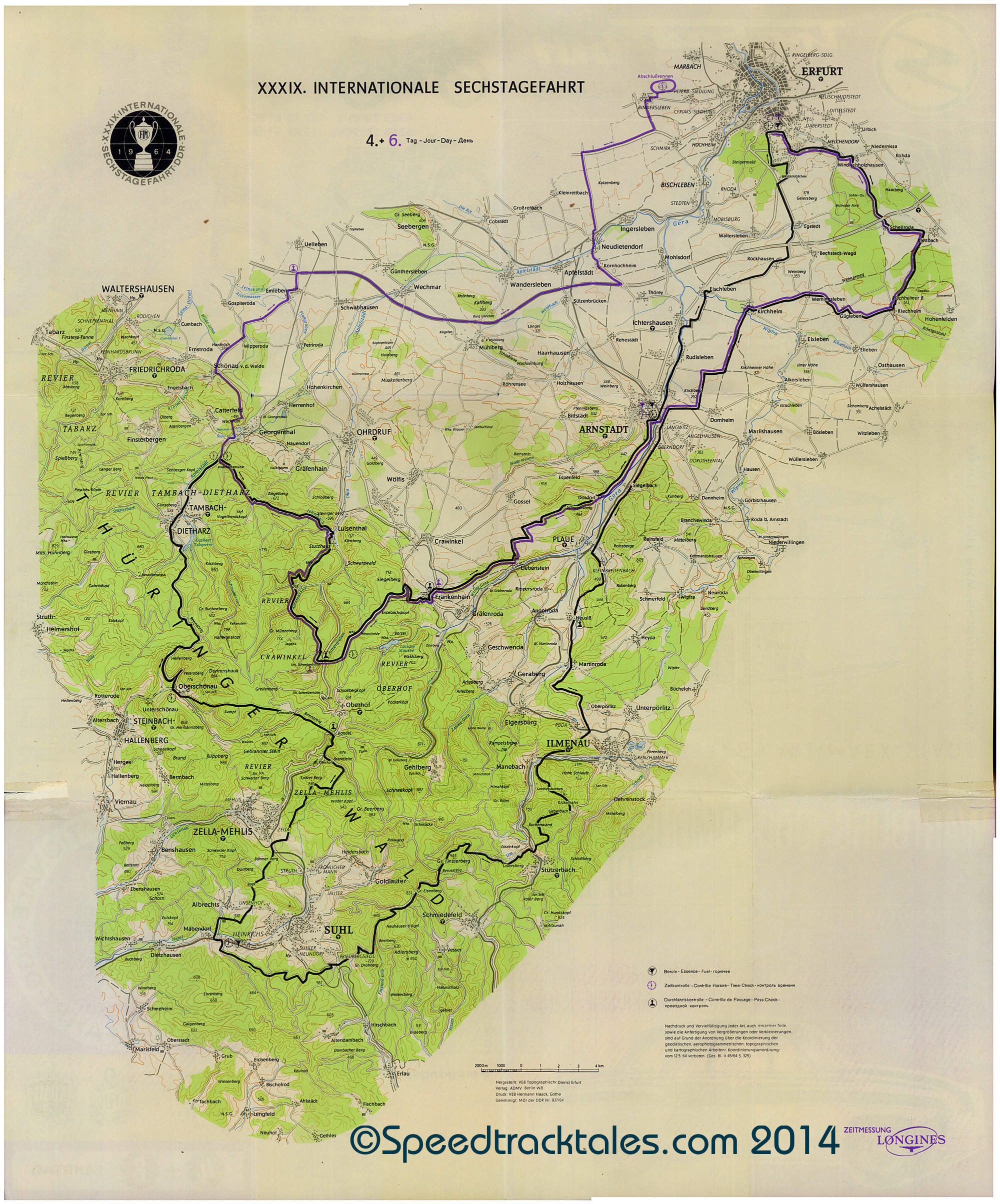
image – Course map Day 4 & 6 ISDT 1964 (Courtesy Harro Esmarch Collection)

Hello,
Is the mapping completed?
Can i find a gpx.- or kml-file anywhere?