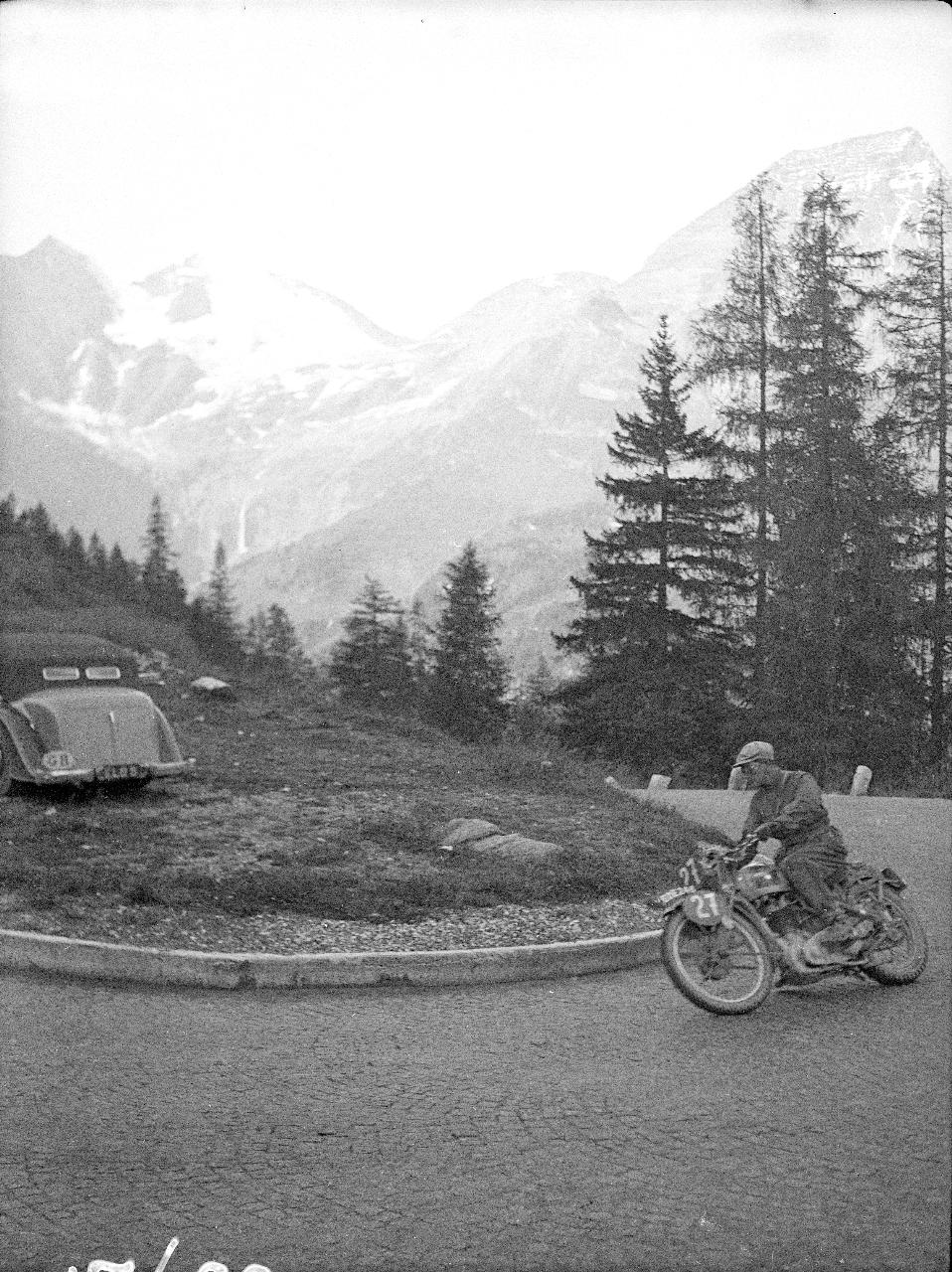
In this Post we are going to create from modern geographic information such as Google Maps, the route of the ISDT 1939. I needed to have a list of destinations for the event to help tagging a recently discovered photo collection to date the images. As there is not as of yet, any detailed mapping of the route used and so until such maps are re-discovered this list of each days stops are taken from the maps provided with the results and programme. User Caveat: As this event was organised by the German Government and Military I presume they could go very much wherever they chose. It is likely that some of the tracks used for the event and featured in this article may cross private land for which to use now, the consent of the owner may be necessary. To decide if this is the case, you may need to do further research, unfortunately, we are unable to give advice.
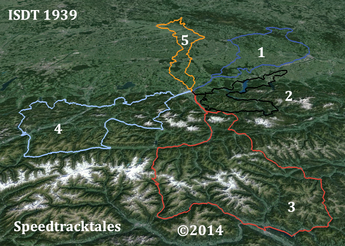
Image – routes of days 1 – 5 ISDT 1939 set out on LANDSAT colour image (Google Earth / Speedtracktales)
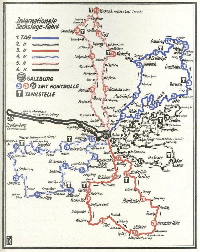
Image – map of all 6 days route ISDT 1939


![photo - the victorious ROYAL ENFIELD 1953 team: Johnny Brittain (Trophy) [LWP 424], Don Evans (Vase A) [LWP 423], and Jack Stocker (Trophy) [LWP 422], all mounted on 500 twins - ISDT 1953 (Speedtracktales collection)](https://speedtracktales.com/wp-content/uploads/2012/04/p1-isdt1953.png)

![Photo - Chat near the check George Wilson with the Triumph [HUE 258], Fred Anning on the left and Frank Jarman ISDT 1950 (Speedtracktales Archive)](https://speedtracktales.com/wp-content/uploads/2012/04/motorcycle19501005-1-isdt1950.png)