
#2 in a never ending series will take a look at how we mapped the route, where did it go and possibly eventually feature points of interest along the way as they exist. As this is an ongoing project and requires an element of local knowledge. In #1 we looked at 1938 and the almost now completed task would not have happened without the help of Colin Jones of the West Glos and Forest of Dean Motorcycle Club. Any further offers of help are welcome please drop us a note, especially for non-Wales route maps
The map so far ( this image will be updated as the work is completed)
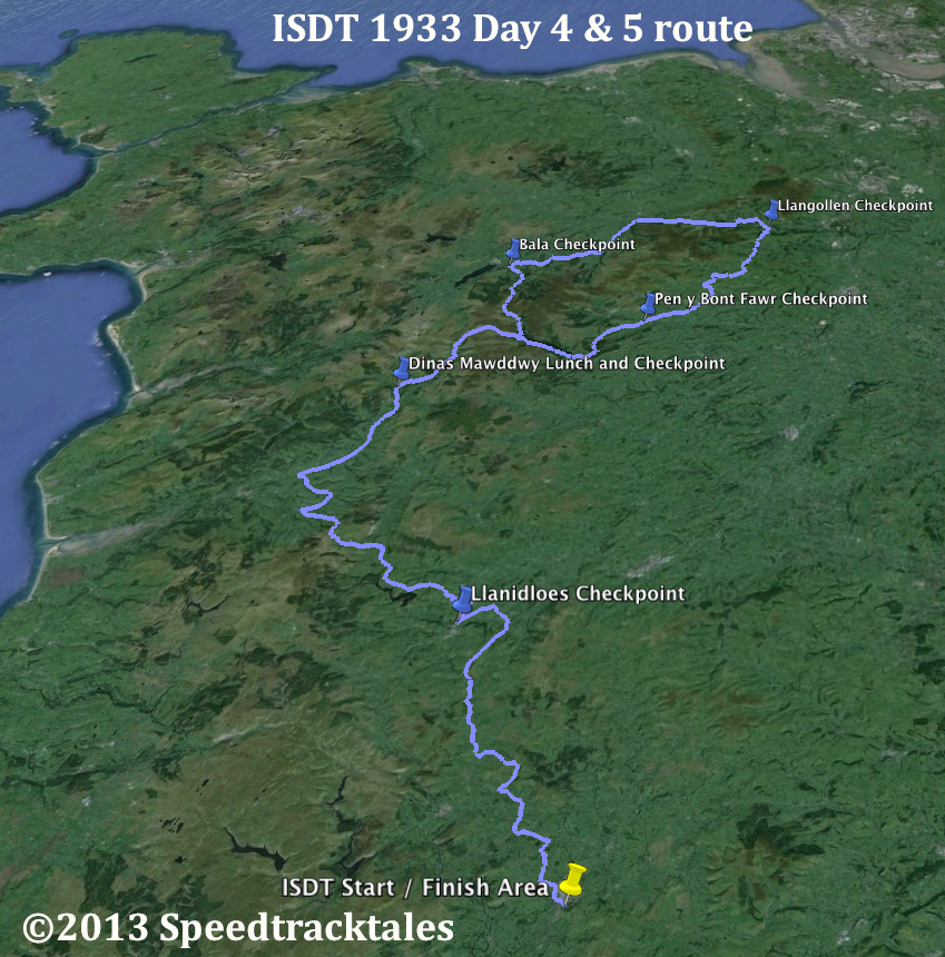
image – route of event with checkpoints days 4 and 5 ISDT 1933
In order to prepare the map I am using Google Earth although dedicated packages such as GPS orientated applications like Memory Map, Anquet Map or GIS packages like Q GIS will be helpful.
The base mapping we are using for the routes remains, until somebody finds the organisers master maps, the map usually made available in the programme
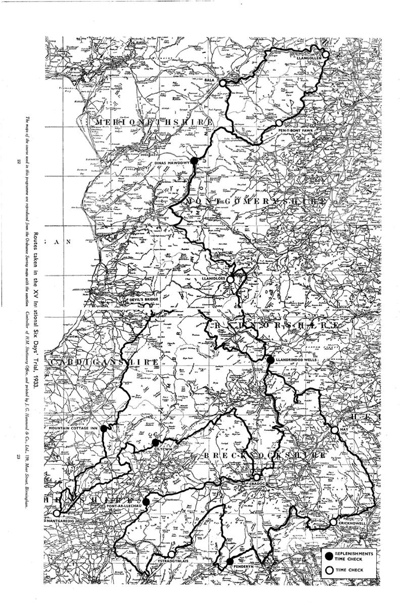
Image – scanned copy of course map for ISDT 1933 (courtesy Wryan collection)
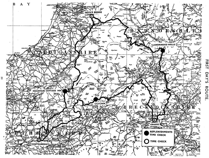
Image of scanned copy of course map for Day 1 ISDT 1933 (courtesy Wryan collection)
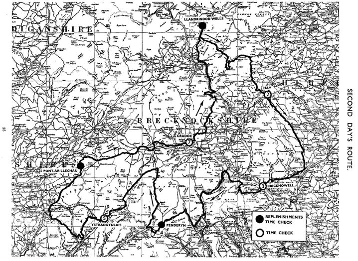
Image of scanned copy of course map for Day 2 ISDT 1933 (courtesy Wryan collection)
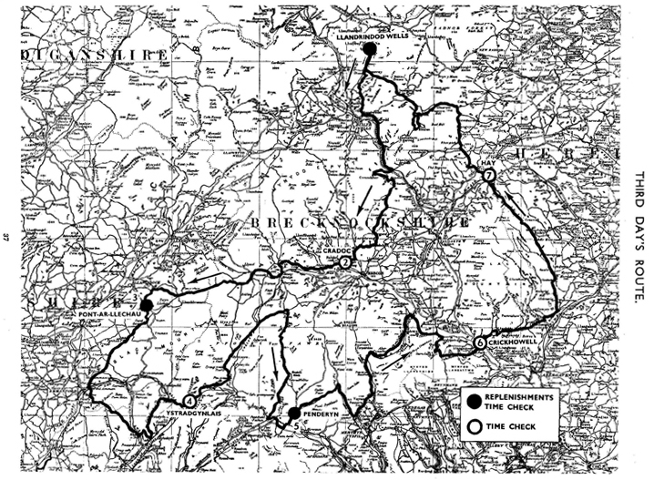
Image of scanned copy of course map for Day 3 ISDT 1933 (courtesy Wryan collection)
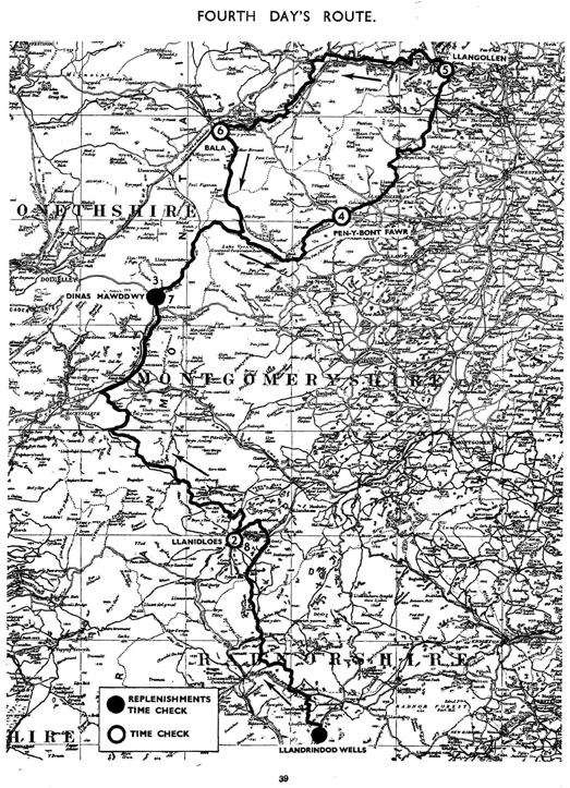
Image of scanned copy of course map for Day 4 ISDT 1933 (courtesy Wryan collection)
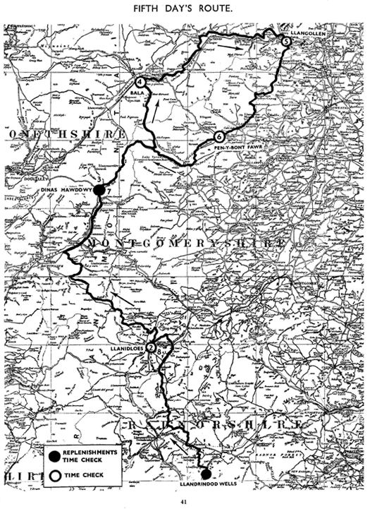
Image of scanned copy of course map for Day 5 ISDT 1933 (courtesy Wryan collection)
Usually it is helpful to have sight of the time checkpoint locations and timings
Because much of central Wales is served by a variety of Trunk Roads, these have been subject to substantial engineering improvements for safety and traffic flow improvements since the ISDT used it and to help identify changes to the road network or tracks which have become lost or planted over by forestry use of the war time OS Mapping at the ‘Vision of Britain’ website is very useful
http://www.visionofbritain.org.uk/maps/
You will need to use the map windows navigation tools and your mouse pointer to locate a detailed map for the area you are interested in.
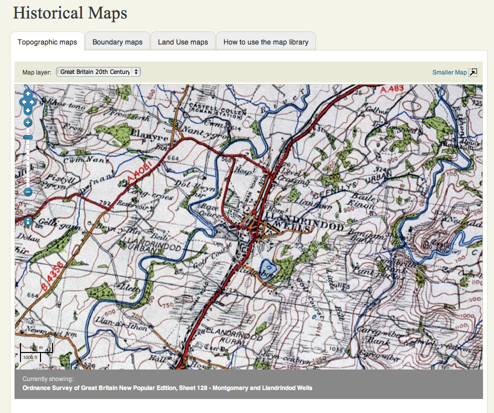
image – c 1940 Ordnance Survey 1″ Sheet 128 Montgomery & Llandrindod Wells (courtesy Vision of Britain / British Library)
see this map here http://www.visionofbritain.org.uk/maps/sheet/new_pop/264_128
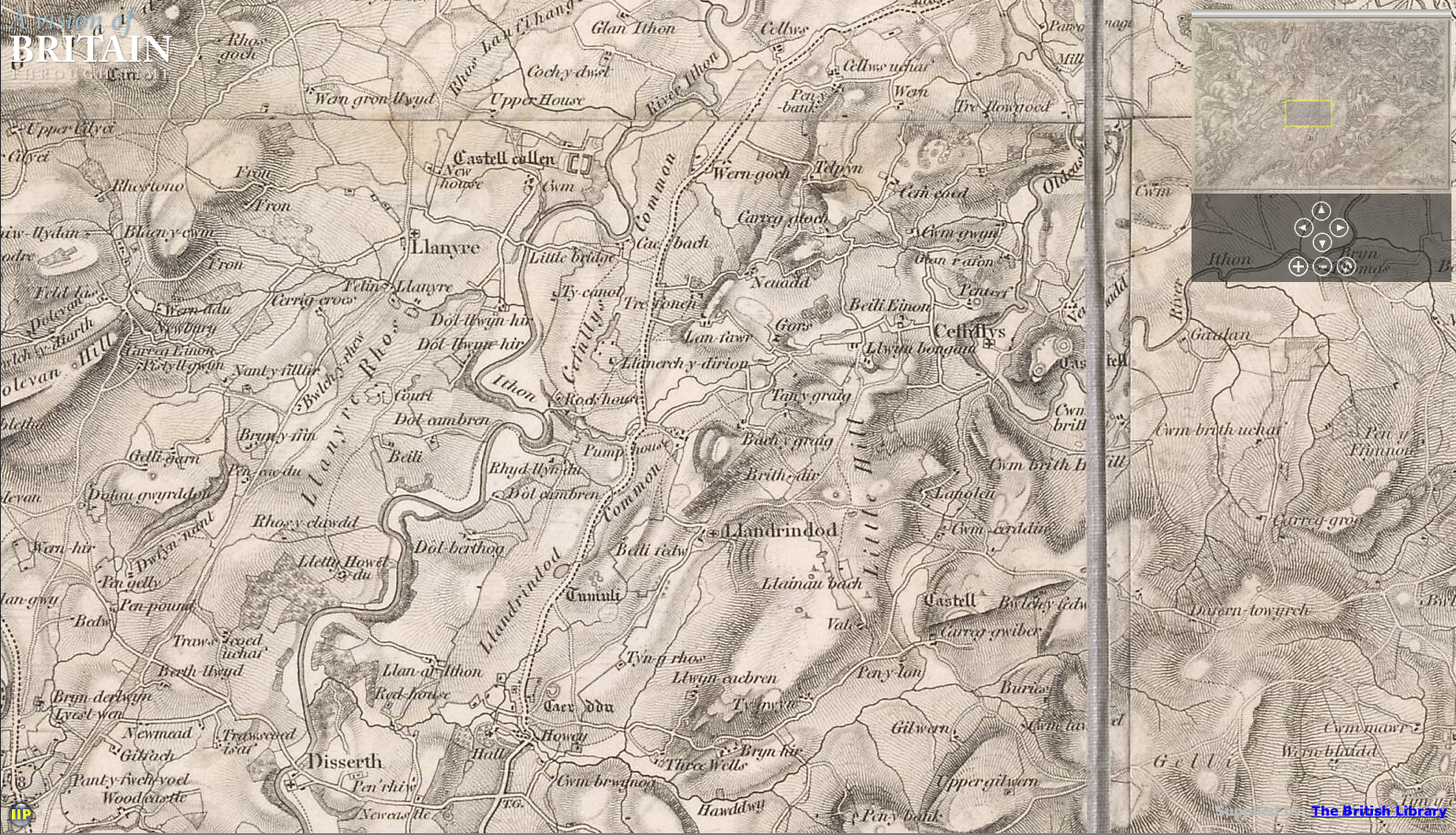
image – Ordnance Survey 1st Series 1″ map Sheet 56 Llandrindod Wells 1833 (courtesy Vision of Britain / British Library)
see this map here http://www.visionofbritain.org.uk/maps/sheet/first_edition/sheet56
Final Maps
All Days
Not yet available
Days 4 & 5
image – route of event with checkpoints days 4 and 5 ISDT 1933
Route ran anti-clockwise Day 4 and clockwise day 5
Course Profile
image – profile of route for days 4 & 5 ISDT 1933
