
Tags
Ammanford, Clydach, Crai, Crickhowell, Dorstone, Eardisley, Hay on Wye, Heol Seni, Hirwaun, ISDT 1938, Llandeilo, Llandovery, Llangattock, Merthyr Tydfil, Pontardawe, Pontarddulais, Rhigos, TalyBont on Usk, Vaynor, Ystalyfera, Ystradfellte, Ystradgynlais
The ongoing mapping of the ISDT route and the availability of Google Streetview makes it fairly easy to see the locations that featured on the route maps as Checkpoints, Fuel and Lunch Stops and other intermediate points. Here we are following the route of the ISDT 1938 as set out in our article on mapping the ISDT 1938
Below are a collection of images taken of the route and hopefully more can be added as the route is revisited by those interested with the history of the ISDT.
Day 1
After the start in Llandrindod Wells at 6.00am there was an introductory check at 1 ½ miles (2.5km) at 7 ¼ miles (11.7km) the riders crossed the river bridge at Cregrina.
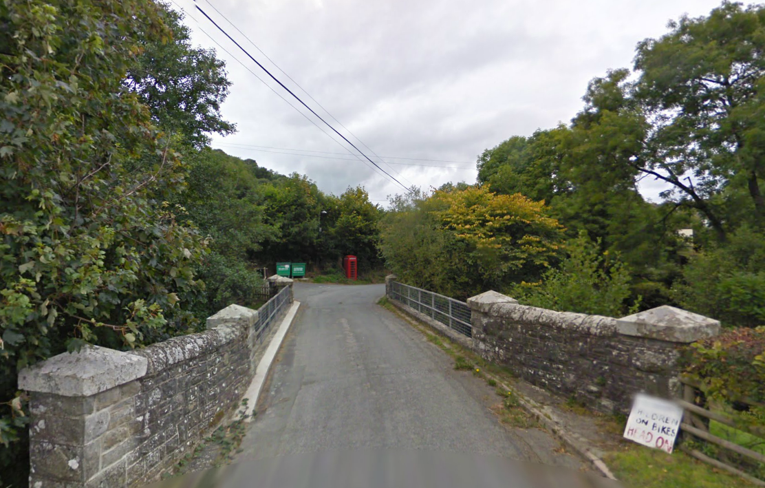
Photo – River bridge at Cregrina on route Day 1 ISDT 1938 (Google Streetview)
The route then headed to the first Time Checkpoint of the day at 26 ½ miles (56.7km) the ‘Bell turn’ in the village of Dorstone which lies just over the border in England in the county of Herefordshire. First rider was due to arrive at 7:23 and the last at 9:15
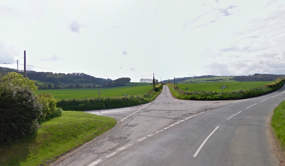
Photo – The Bell turn at Dorestone, Herefordshire on route Day 1 ISDT 1938 (Google Streetview)
From Dorstone the course headed 14 ½ miles ( 23.3km) to cross the road bridge over the River Monnow at Craswall, still in Herefordshire.

Photo – Bridge over the river Monnow at Craswall on route Day 1 ISDT 1938 (Google Streetview)
After a further 9½ miles (15.3km) the riders arrived at the next time checkpoint at Capel y Flin, the first rider arriving at 8:21 and last at 10:13.

Photo -Capel y Fin on route Day 1 ISDT 1938 (Google Streetview)
Heading onto Crickhowell to cross the river Usk by its medieval bridge at 16¼ miles (26.2Km)
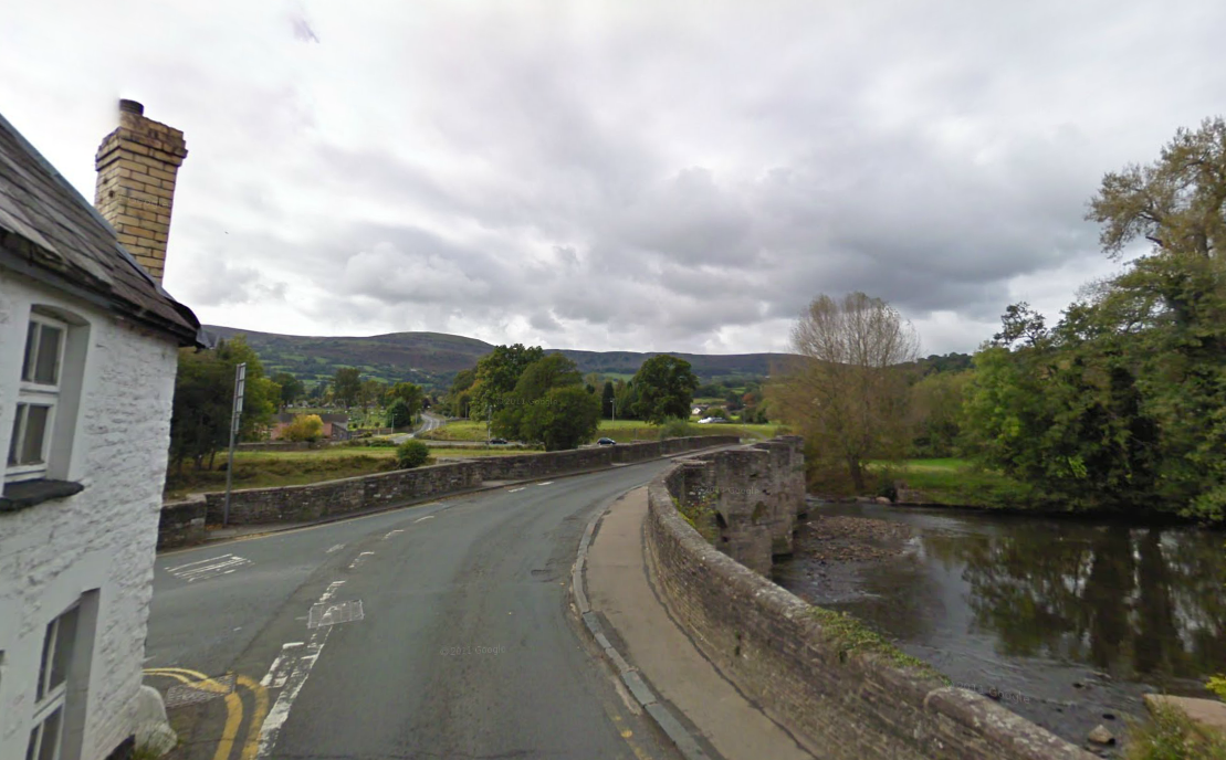
Photo – Medieval bridge over the river Usk at Crickhowell on route Day 1 ISDT 1938 (Google Streetview)
After 19 miles (30.6km) riders reached the next checkpoint at Ystrad Gynwyn at 9:42 with the last riders coming in at 11:34 somewhat late for their ‘elevenses’ although even today a Wall’s Ice Cream can be had. A fuel stop was set up about a mile further on by the Pontsticill Reservoir that was at 96 miles.
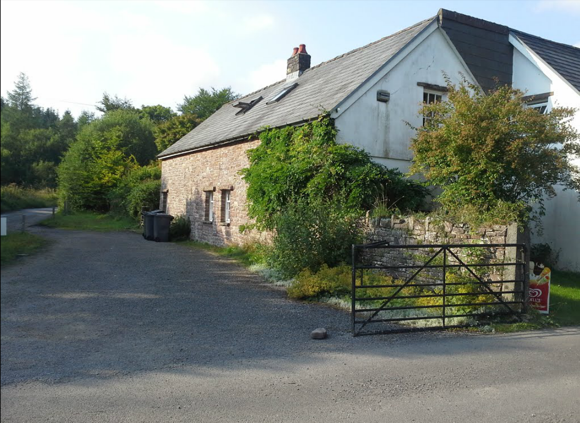
Photo – Ystrad Gynwyn on route Day 1 ISDT 1938 (Google Streetview)
After fuel the riders travelled 16 miles (25.8km) to reach Cefn Rhigos
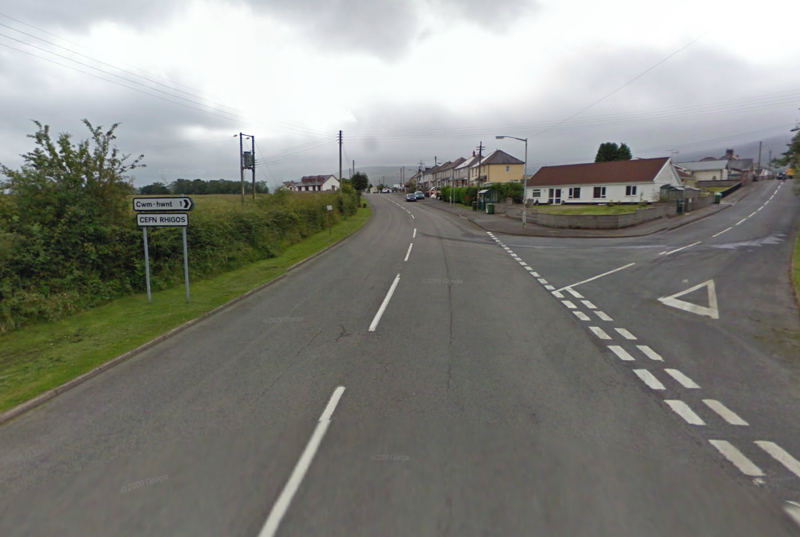
Photo – Cefn Rhigos on route Day 1 ISDT 1938 (Google Streetview)
At Cefn Rhigos we find on of the places the route once ran down a classic section of going to Dinas Rock. The construction of a new section of the A465 cut directly across the old route, with the new road being set in a deep cutting the old road was severed without a diversion, closing the road and stopping access to Dinas Rock
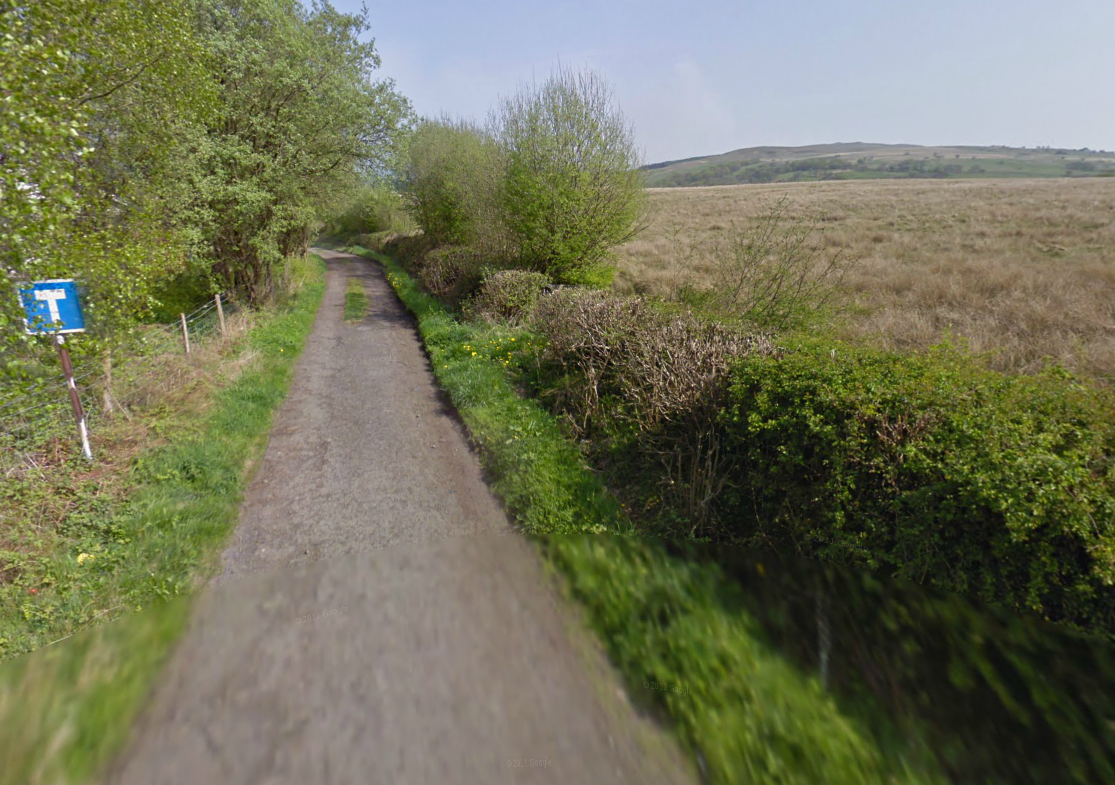
Photo -The Route at Rhigos now features a culs de sac sign on the route Day 1 ISDT 1938 (Google Streetview)
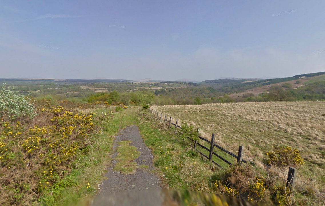
Photo – Where the tarmac runs out, with a wonderful view to distant moorlands on route Day 1 ISDT 1938 (Google Streetview)
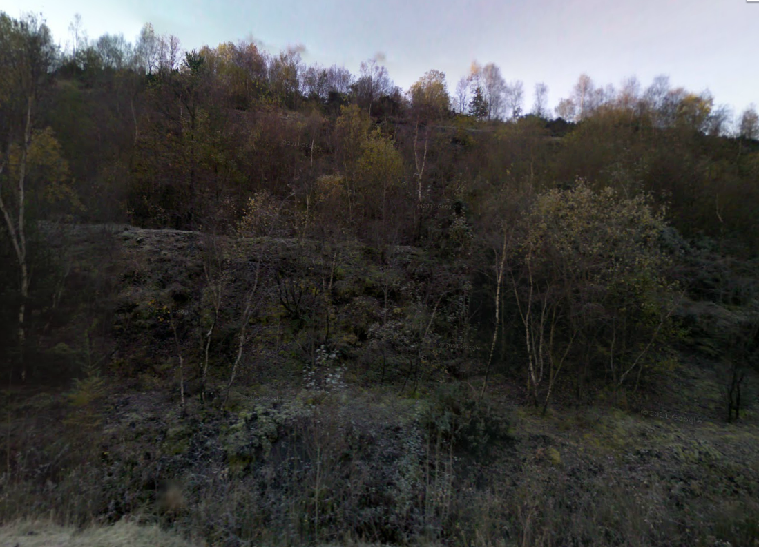
Photo – From the bottom of the A465 cutting near Cefn Rhigos the on route Day 1 ISDT 1938 (Google Streetview)
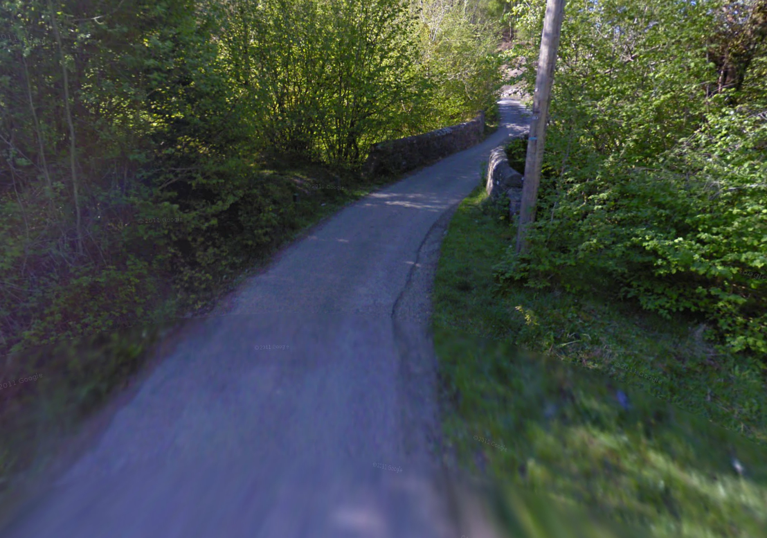
Photo -Where the road from Cefn Rhigos shoudl have reached Dinas Rocks on route Day 1 ISDT 1938 (Google Streetview)
Dinas Rock, of which there are many memorable images of the severity of the track at Dinas causing difficulty for many riders is now a Countryside Site managed by the Forestry Commission and the Powys Council who have closed the old track and built a visitors car park
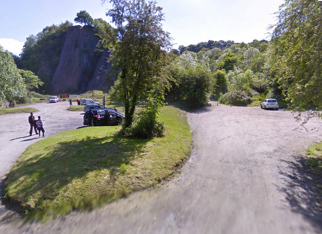
Photo – the old track at Dinas Rock on route Day 1 ISDT 1938 (Google Streetview)
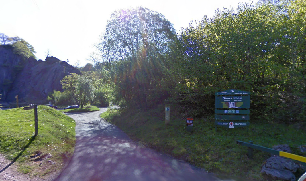
Photo – Visitor Car Park at Dinas Rock on route Day 1 ISDT 1938 (Google Streetview)
From Cefn Rhigos and Dinas Rock riders headed 18½ miles (29.8km) onto Crai (Cray) where they had a check point and a lunch stop. Early riders would enjoy lunch early at 11:05 whilst the last arrivals were expected 12:57.
Photo – Lunch stop at Crai (Cray) on route Day 1 ISDT 1938 (Google Streetview)
Crai sat at almost exactly the half way point for day 1. After being fed and watered competitors now had to ride 8¾ miles (14.1km) to reach the road junction at Dderi. The A4067 has been much improved here and the junction has been altered. The old pub however looks forlorn and very much bypassed by fast traffic as it desperately waits for a new landlord.
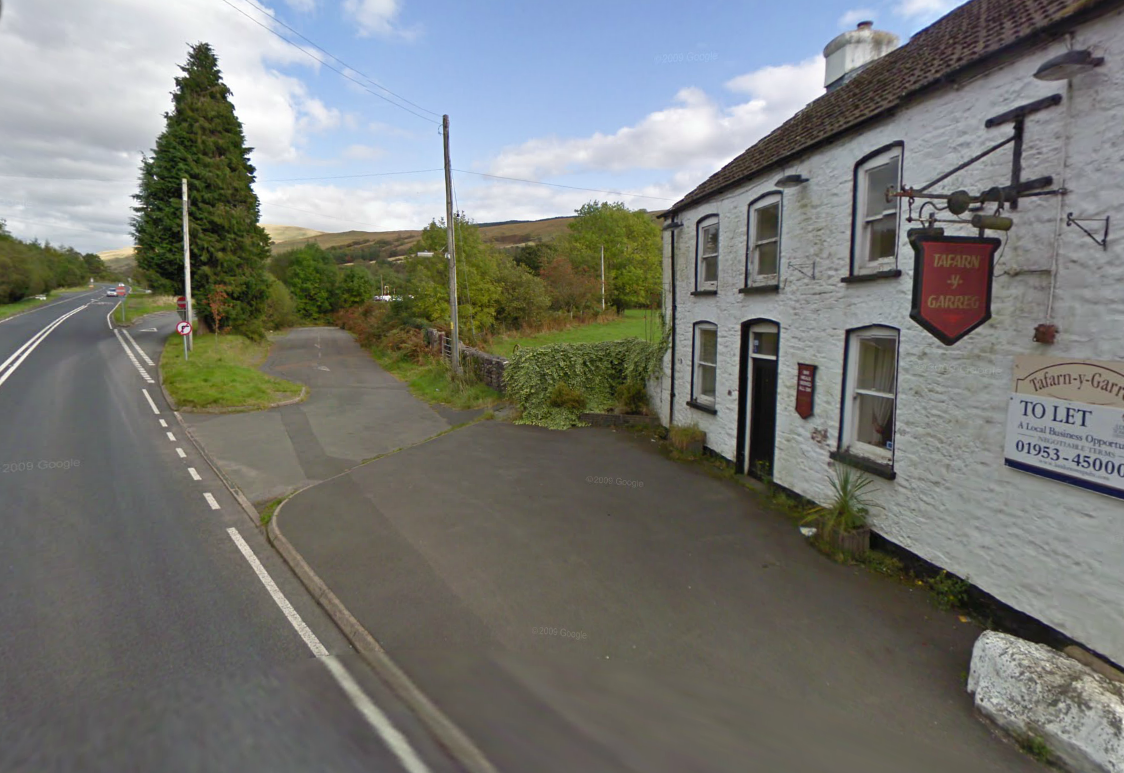
Photo – Tafarn y Garreg ot the Dderi junction on a much improved A4067 on route Day 1 ISDT 1938 (Google Streetview)
9¾ miles further on at 12:17 the first riders were arriving at the Cwm Twrch checkpoint with the last riders passing 14:09. More road improvements over the last 60 years mean this location too has considerably changed since 1938
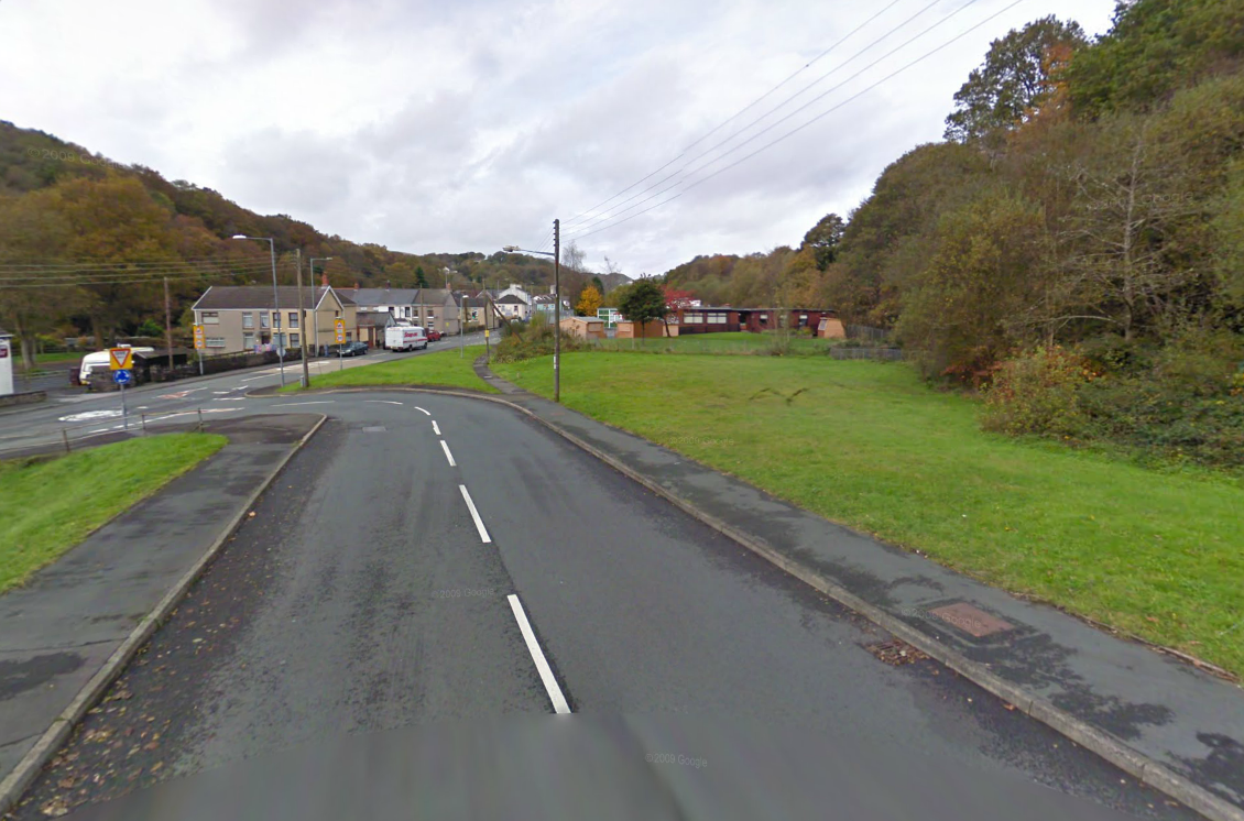
Photo – Cwm Twrch checkpoint on route Day 1 ISDT 1938 (Google Streetview)
From Cwm Twrch just outside the industropolis of Ystradgynlais, gateway to Swansea and Neath, on the river Tawe riders headed 7½ miles (11.7km) to Llangiwg Church
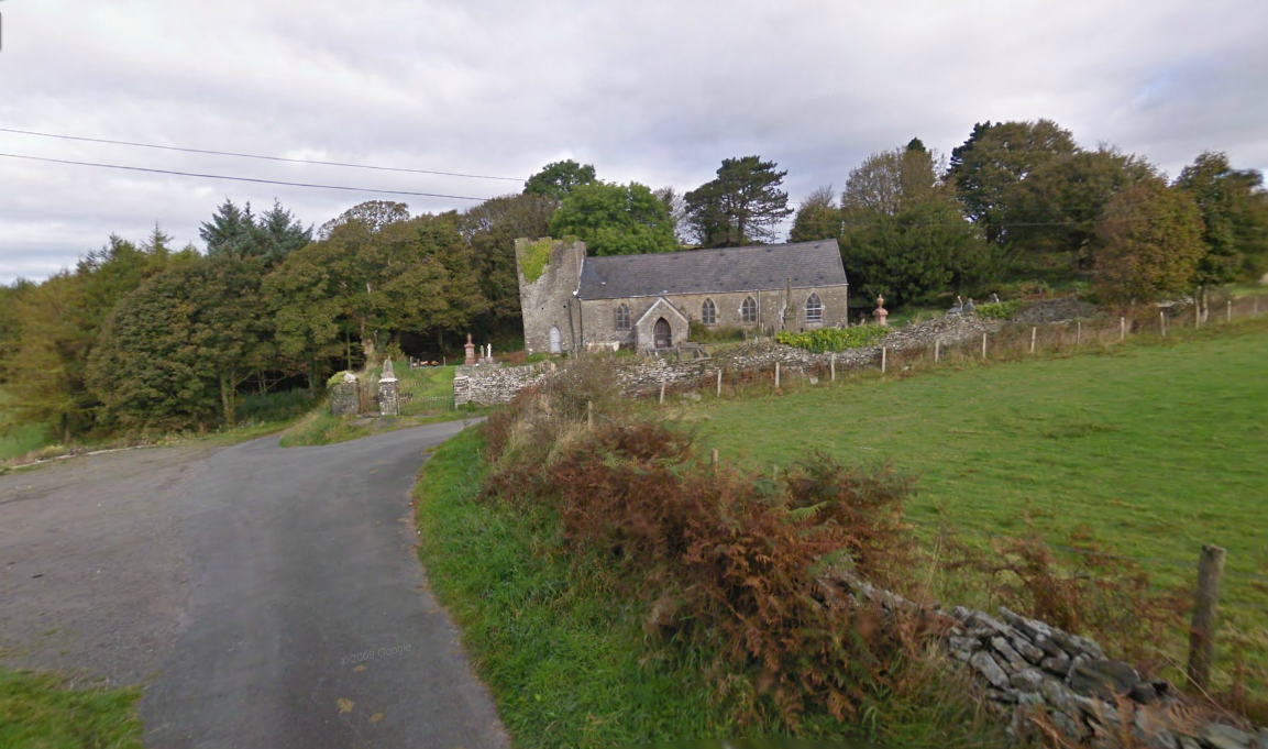
Photo – Llangwig Church on route Day 1 ISDT 1938 (Google Streetview)
From Llangwig Church it was a 9¾ mile (15.7km) ride to the next checkpoint at Bwlch y Gwynt, a farm just outside Clydach, arriving at 12:59, some 6 hours after the start. The last riders coming in about 14:51.
Photo – Bwlch y Gwynt on route Day 1 ISDT 1938 (Google Streetview)
From Bryn y Gwynt the course headed to cross the river Amman at Pontamman near Ammanford. The old bridge remains in situ but has been closed off and replaced by a substantial and newer structure when the A474 was upgraded and improved passing through the Amman valley.
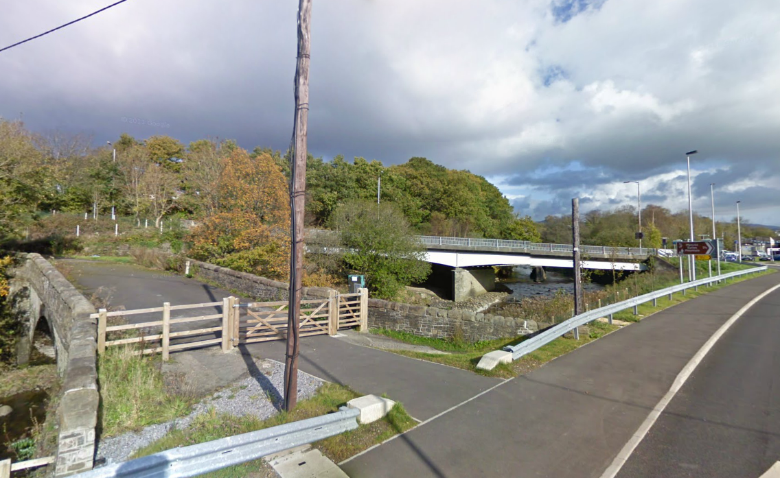
Photo – Old pont Amman on route Day 1 ISDT 1938 (Google Streetview)
heading on from Ammanford headed 2½ miles to reach a further fuel stop and heading north then north east back into rural lands riders the route following what is now the western boundary of the Brecon Beacons National Park by passed Llandeilo before heading 14½ miles (23.4km) to a checkpoint at Bont Fawr.
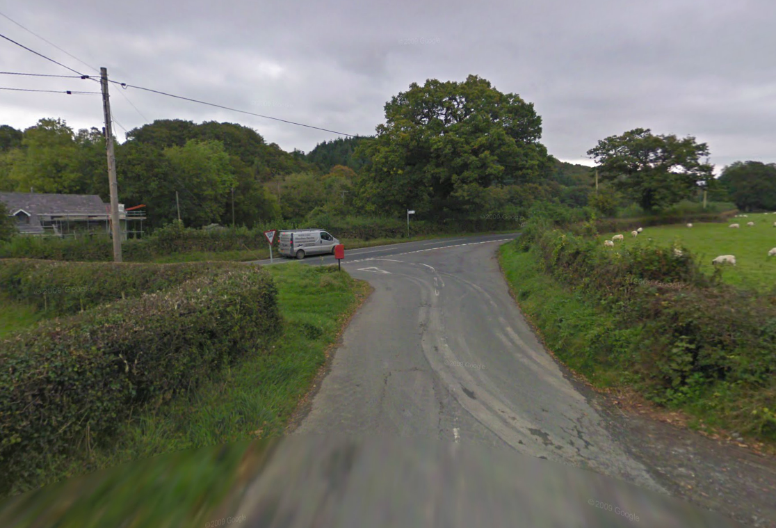
Photo – Bont Fawr checkpoint on route Day 1 ISDT 1938 (Google Streetview)
Still on the National Park Boundary at a junction on the A4069 after about 195 miles of riding the first riders arrived at 14:06 with the last riders at 15:58. The course continued to head north easterly and in 14¼ miles (22.9km) the course crossed the A40 at Pentre Bach. Here today we see one of the far too often disasters that befall our old minor road network. Alas the road closure sloths, those council clerk guardians of maladministration and predjudice have decided that this rare section of remaining ISDT route still an unsurfaced track needed to be closed to the exclusive use of pedestrians and equestrians. Without knowing further reasons why this has happened I shall avoid speculating. However the photographic proof is here for all to see on Google Streetview.

Photo – Bad news announcement approaching track leading to Pentre Bach on route Day 1 ISDT 1938 (Google Streetview)
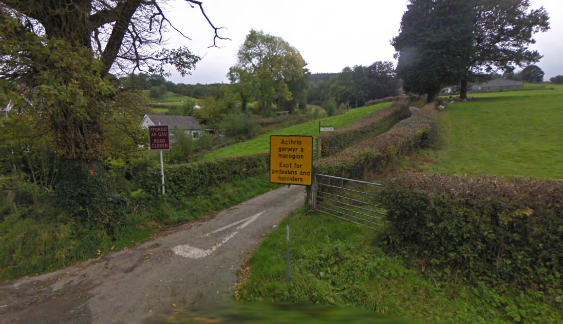
Photo – Matching insults erected at the Pentre Back end of the track at the A40 junction on route Day 1 ISDT 1938 (Google Streetview)
From Pentre Bach and its small bridge over the Afon Gwydderig riders headed 8¾ miles (14.1km) to a check set in the countryside 1 mile North east of Llandeilo’r Fan arriving mid afternoon at 15:02 if early or tea time 16:58 if late.
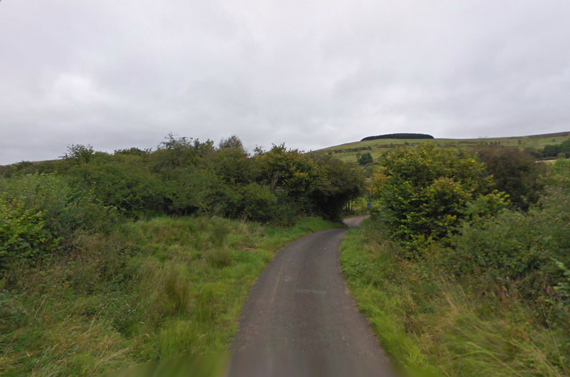
Photo – on route Day 1 ISDT 1938 (Google Streetview)
Fairly remote countryside greeted the checkteam who would have used a roadside waste like this to set up the check. From here riders had a 10½ mile ride to Pentre Lloegr (a welsh name meaning English Village). (Check out Arthur Williams’s comment as to the correct location of the check)
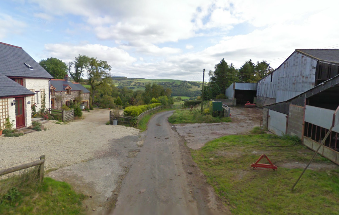
Photo – Pentre Lloegr on route Day 1 ISDT 1938 (Google Streetview)
Not much more than a farm with a collection of related dwellings this point was on route to the next check in a further 9 miles (14.5Km) at Pen Cae Melyn, another farmstead, where the first riders would clock in at 15:48 while the days tail enders would be in at 17:40
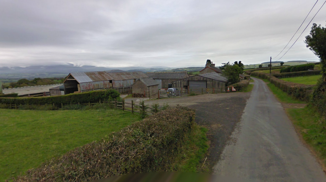
Photo – Pen Cae Melyn Checkpoint on route Day 1 ISDT 1938 (Google Streetview)
From Pen Cae Melyn Checkpoint riders headed 9½ miles (15.3Km) to Erwood Checkpoint. Erwood is a small village set on the side of the river Wye on the A470. The exact location of the check is uncertain. The first riders arrived at 16:12 and the last at 18:04.
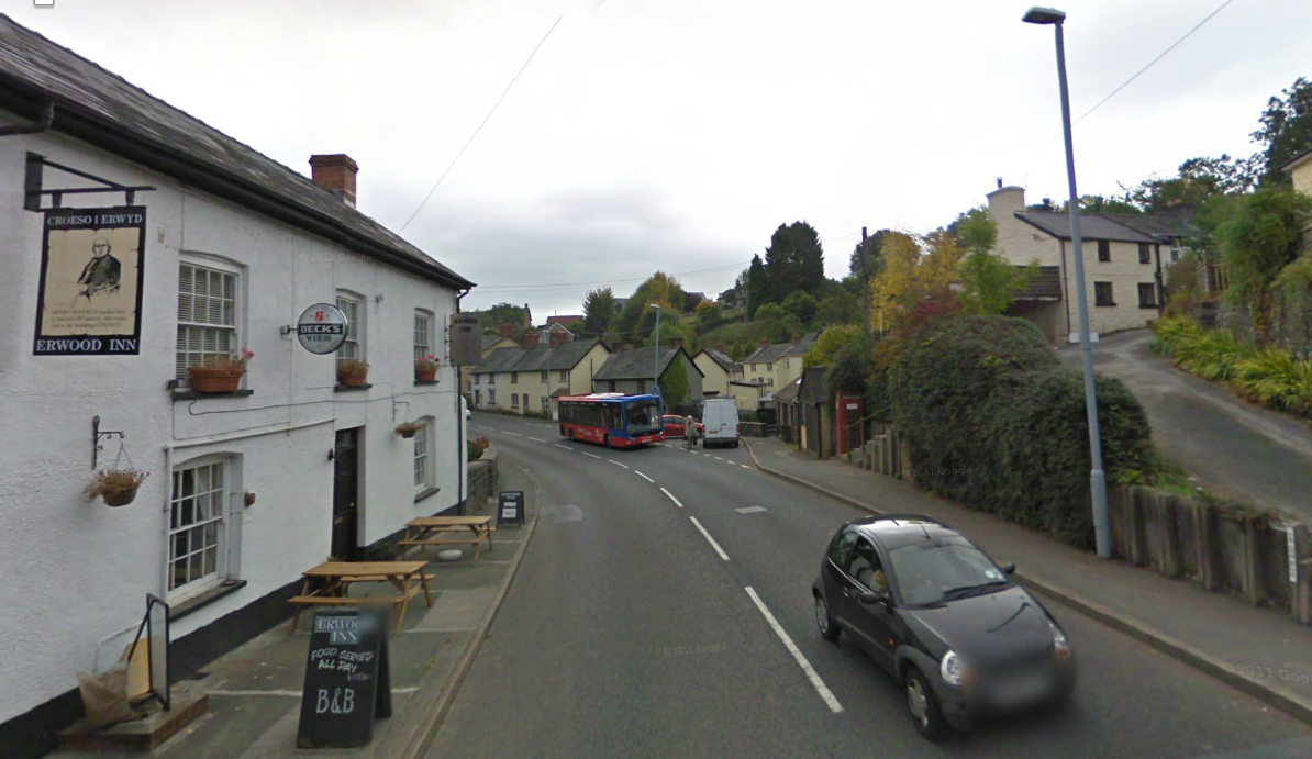
Photo – Erwood village on route Day 1 ISDT 1938 (Google Streetview)
After Erwood the riders had a 9½ miles (15.3Km) slog to take them back to the river bridge at Cregrina that the riders had all passed some 10 hours earlier heading in the opposite direction. From the bridge it was a 10 mile ride back into the finish at Llandrindod Wells a total ride of 266½ (429.1Km) with the first rider arriving at 16:57 whilst the last would not arrive until at least 18:50 if they had not been delayed.
Day 2
Day 2 started with at 6am on the 12th July 1½ miles later it was the initial road check and then the riders headed off to yesterdays 7¼ miles (11.7Km) crossing the Cregrina Bridge. A further 9½ miles (15.3Km) led to the first proper checkpoint of the day at Erwood first on the road arriving at 6:42 last man 8:37. A further ride for 9½ miles (15.3Km) brought the next checkpoint at Pen Cae Melyn at 7:07 up to 9:00. Another 9 miles (14.5Km) passed Pentre Lloegr again and in 10½ miles (16.9Km) arrived after nearly 50 miles at the next check at Llandeilo’r Fan first rider arriving 7:53 and last rider 9:45. A ride of 8¾ miles (14.1Km) saw riders reaching Pentre Bach where they turned onto the A40 rather than follow yesterdays trail in reverse. The course now headed 13¾ miles (22.1Km) to the village of Cilycwm. Im not sure where the check actually was located but there is a chance it was not far from the village pub which features in this recent photo. First riders arrived 8:47 and last riders at 10:39.
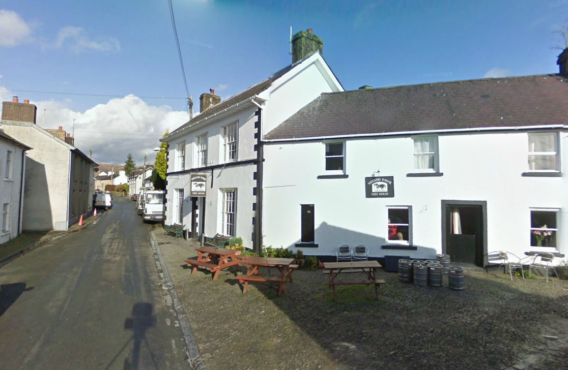
Photo – Cilycwm checkpoint and the Neuadd Fawr Inn on route Day 2 ISDT 1938 (Google Streetview)
From Cilycwm the riders went 12¼ miles (19.7Km) to their first fuel stop at 82 miles (132Km). After fuel came a 7¾ miles (12.5Km) ride to pass over the cross roads at Halfway.
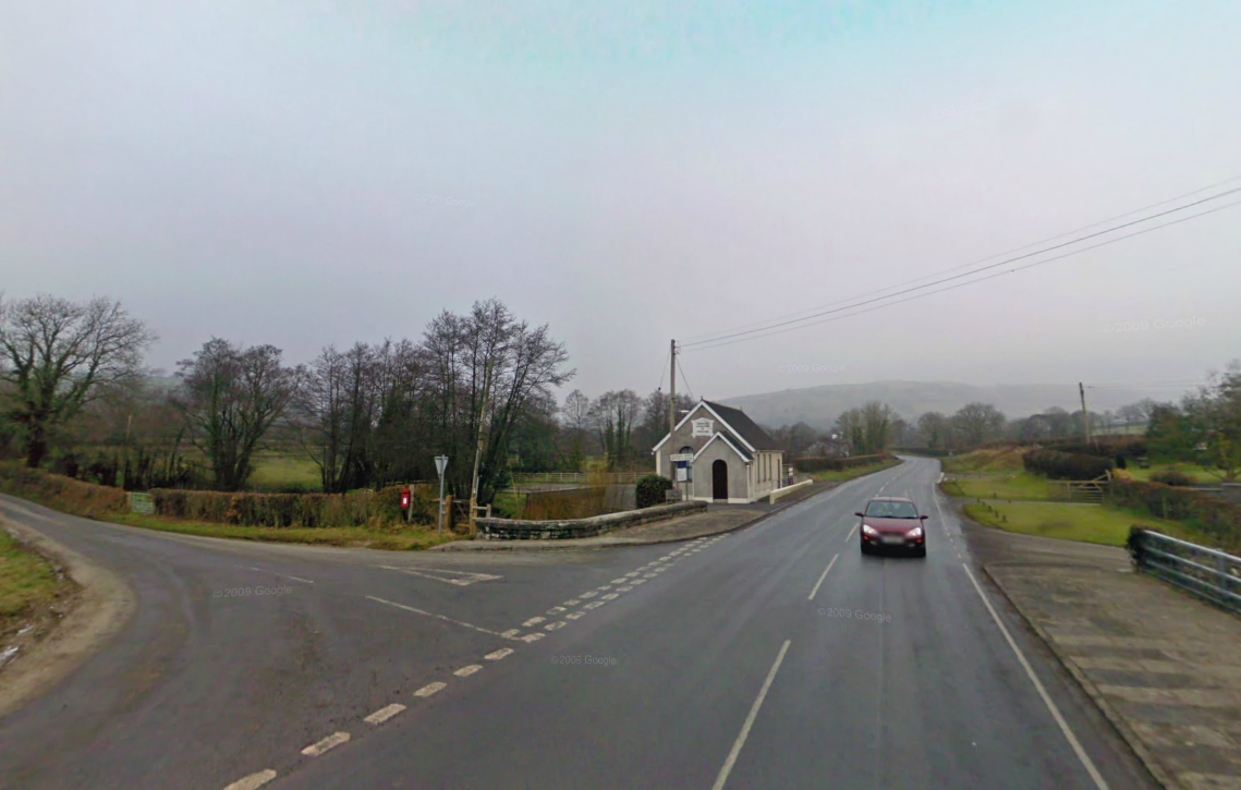
Photo – Halfway junction B4302 road to Talley on route Day 2 ISDT 1938 (Google Streetview)
From Halfway the riders had to cover 17 miles (27.4Km) to reach the Dyffryn Checkpoint at a total of 106 miles first rider arriving 10:16 and the last at mid day 12:08.

Photo – Dyffryn Checkpoint on route Day 2 ISDT 1938 (Google Streetview)
From the Farm at Dyffryn which lay to the south of Brechfa riders had a 14½ miles (22.9Km) ride to the pass by the Railway station at Llanpumpsaint heading on to the checkpoint at Talog.
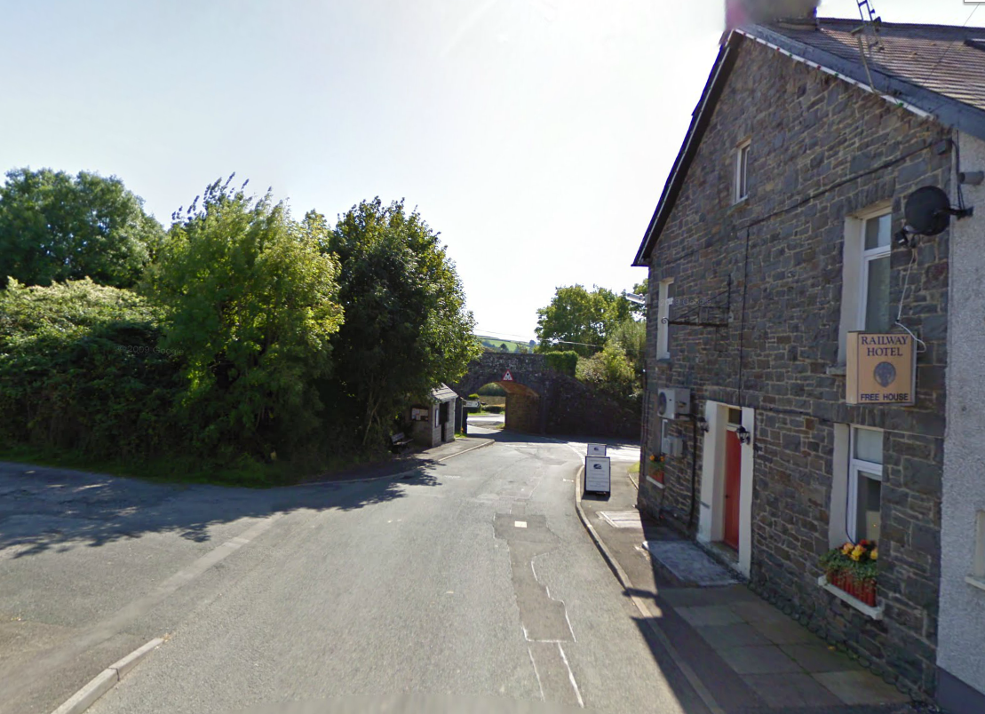
Photo – Railway Inn at Llanpumpsaint on route Day 2 ISDT 1938 (Google Streetview)
Just as we saw earlier how the old ISDT route had suffered since 1938 by the blighting effect of modern times highway planners and more lately the dereliction of duty and disregard by council staff who do not wish to maintain our old road network Here in a village named after 5 brothers, who were early celtic christians and helped establish the church in the 5th or 6th century in this area, sees another abandoned part of the nations once vital transport infrastructure. Llanpumpsaint got its railway in 1860 and eventually sat on an active line running between Carmarthen and Aberystwyth. It,alas, came to feel part of the brunt of the Dr Beeching review and closed to passengers in 1965 although freight was retained until 1973. Like many old abandoned transport links at some point they get a phoenix like chance to be reborn and in the case of this line nearby in 1978 a group of enthusiasts ‘Gwili Steam Railway’ reopened a short section as a heritage line and it is hoped one day it will extend as far as Llanpumpsaint.
The riders headed the 16 miles (25.8Km) to the checkpoint at Talog where the first riders pulled in at 11:29 and the last riders were due at 13:21.
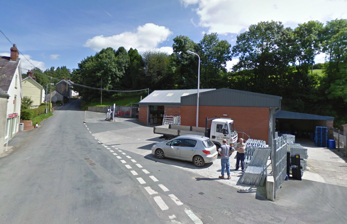
Photo – Talog checkpoint on route Day 2 ISDT 1938 (Google Streetview)
After Talog a 13 mile (20.9Km) ride took entrants over the junction at Crug Bach
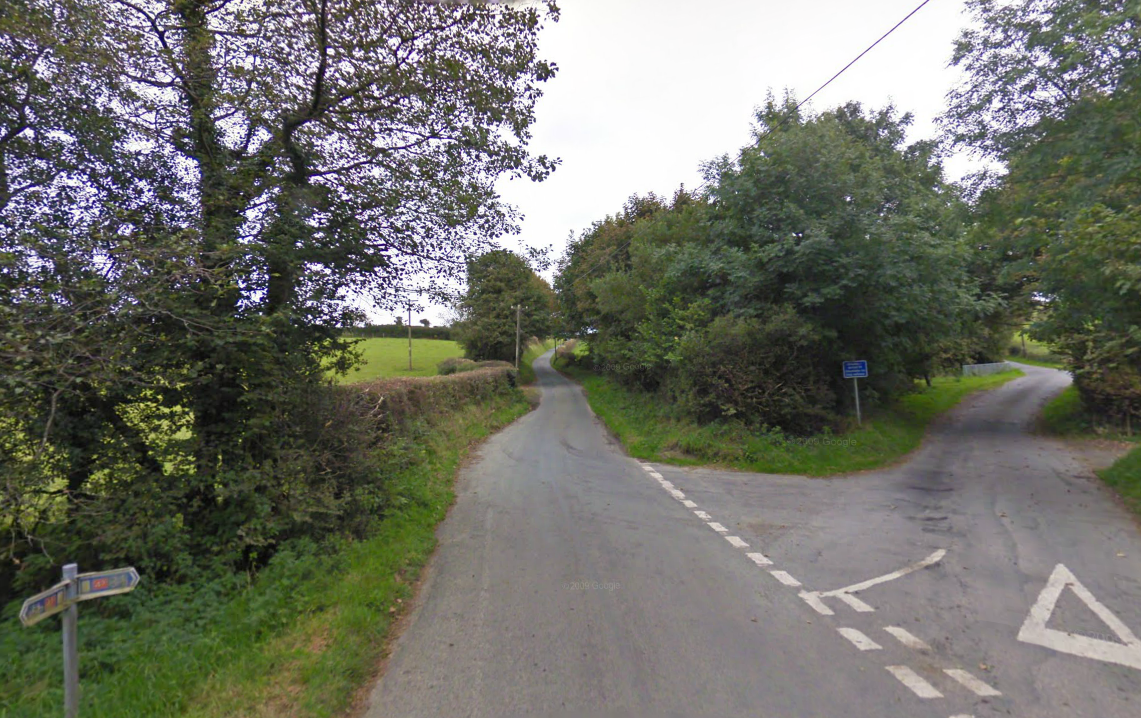
Photo – Junction at Crug Bach on route Day 2 ISDT 1938 (Google Streetview)
After Crug Bach a 6¾ miles (10.9Km) ride took riders to reach the days lunch stop and checkpoint at the Crymmych Arms at Crymych which was the farthest west this part of the route went. Riders began to arrive at 12:15 after 156¾ miles (252.4Km) the last riders arriving at 14:07.
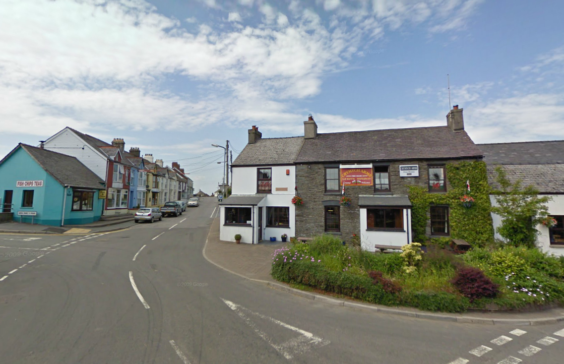
Photo -Lunch stop at the Crymmych arms in Crymych on route Day 2 ISDT 1938 (Google Streetview)
After lunch the riders set out to finish the second half of the route heading 11½ miles (18.5Km) to pass by the church at Capel Ifan.
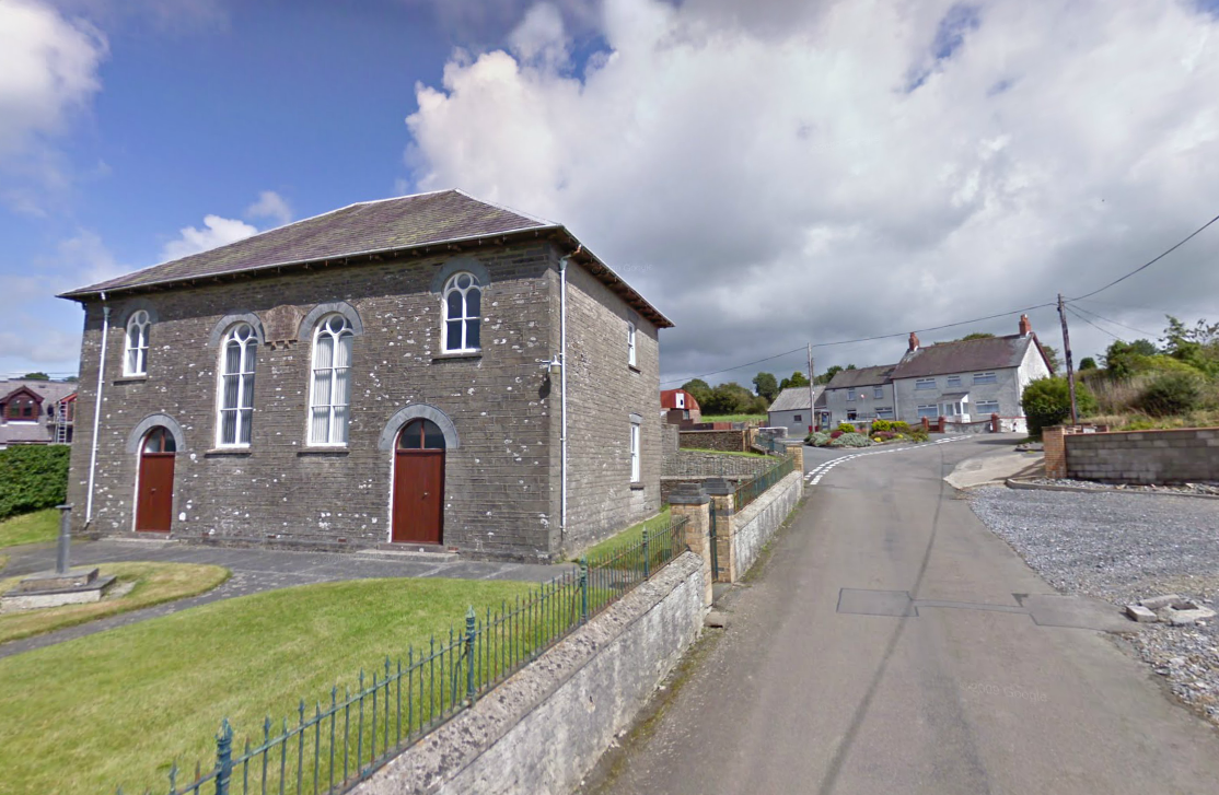
Photo – The chapel at Capel Iwan ( Ifan) on route Day 2 ISDT 1938 (Google Streetview)
After Capel Ifan riders had a further 13¾ miles (22.1Km) to reach the second fuel stop of the day then a further 11 miles (17.7Km) to reach the next checkpoint at Pencader. The first riders arriving at 14:10 and the last riders at 16:02.
Photo – Pencader checkpoint on route Day 2 ISDT 1938 (Google Streetview)
From Pencader riders headed 20½ miles (33Km) to pass the Mountain Cottage Inn which in previous years had been the location of a time checkpoint but not this time.
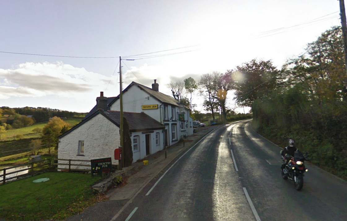
Photo – Mountain Cottage Inn A482 south of Lampeter on route Day 2 ISDT 1938 (Google Streetview)
Well little did that BMW big trail bike rider realise his sighting of the Google Streetview Cam Car would propel his image to appear in a feature on the ISDT. After a 17¼ miles (27.8Km) all riders had to stop at the days next checkpoint in Tregaron.
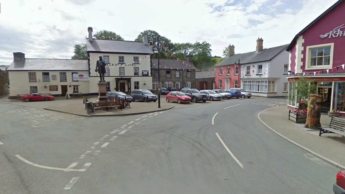
Photo – Tregaron checkpoint on route Day 2 ISDT 1938 (Google Streetview)
Tregaron lies to the west of the Cambrian mountains and the section leading to the next check at Abergwesyn saw a hard ride with many deep river crossings over a mountain road of the Cambrian Mountains.
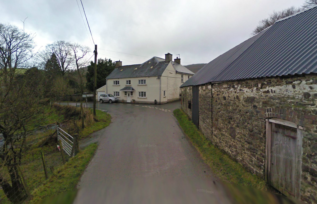
Photo – Abergwesyn Checkpoint on route Day 2 ISDT 1938 (Google Streetview)
The riders having now completed a grand total of 244 miles (392.8km) had to ride 11¾ miles (18.9Km) to pass the church of Llanafon Fawr and then 13¾ miles (22.1Km) onto the finish at Llandrindod Wells a total ridden distance for the day of 269½ miles (433.8Km)
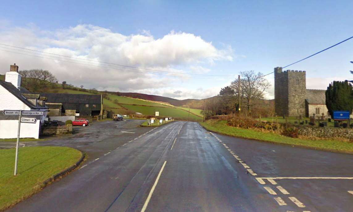
Photo – Church at Llanafon Fawr and church on route Day 2 ISDT 1938 (Google Streetview)
As a quick photographic history of the route in modern times I hope we can share further editorial and visitors photos of the route as it is today in future updates to this page.

Excellent work, it should be interesting make comparison with I’ld site photos. Ciao Riccardo
the checkpoint at pentre lloegr was up the lane above the farm they came across the hill on the right…there is such a myriad of lanes and tracks over the ranges it would be impossible to know them all….the checkpoint at llandeilo fan is visible on google head to the ranges and on your rigt a sentry point they came down there
Thanks Arthur. I need check through this a bit more with you given your knowledge.
Arthur, is there any chance you could find the location of the check on streetview? if not dont worry, also do you have any idea of why the road at Pentre Bach is closed , those signs look temporary and do not indicate a Traffic Regulation Order has been used
the pentre bach that i know is between pentrefelin and llandeilo fan there is a track from there which comes out at llywell that has been closed because ol severe damage by 4×4 donkeys i suspect that was a part of the route